Lost Colonists Site X Theory
A New Theory from the Discovery of a Hidden Fort on an Old Map
This is the Theory #7 of the Fate of the Lost Colonists (out of 8 theories).
Background of John White's Map
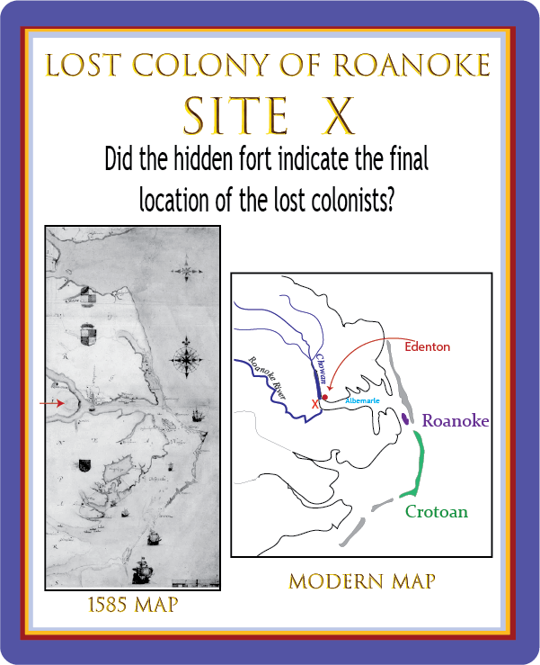
In 1584, John White was on the original expedition to Roanoke. He was a painter and illustrator. A copy of his map is on the left above. After this 1584 expedition, the English had a plan to return and settle on or near Roanoke Island.White was also part of the 1585/1586 military expedition, again as a painter/illustrator. The outcome of this expedition was that Roanoke was rejected as the site of the soon-to-be planted colony, largely because of the shallow bays which destroyed one of their ships, and the poor relationship caused mainly by the military explorers.
White returned in 1587 with the famed and doomed 117 Roanoke settlers, whose fate is still debated. This time, he was the govenor of the colony - a promotion made by Sir Walter Raleigh. A major question of the 1587 venture is why they were left on Roanoke island, which had been rejected as the place of settlement, instead of their intended destination - the Chesapeake Bay - 50 miles to the north.
White's written testimony indicates a constant tension with the pilot Simon Fernandez. White stated that not only did Fernandez not take them to the Chesapeake, he refused to allow them to stop to get supplies in the West Indies as planned, and left them on Roanoke where they were surrounded by hostile tribes. The assassination of one of their leaders by natives shortly after their arrival indicated their danger.
With the entire colony pleading with White to return to England and get them help, White relunctantly agreed to go. The conflict with the Spanish Armada delayed his return for three years.
His 1590 journey to find Roanoke Island empty and the settlers gone produced one of the nation's earliest mysteries. His writings have been studied, his maps searched, the questions debated over and over again.
White's Map: A New Discovery
2012
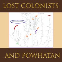
An interesting thing happened to White’s art work. About 100 years ago someone discovered many of his original paintings, including that map. They are stored in the British Museum in London.Do you notice a little blotch on the map on the west side of Abermarle Sound?
That little blotch was, in fact, first noticed in 2012 by the First Colony Foundation.
A representive flew to the British Museum in London to investigate. They found that White had painted over that small section. The painting was put on a light box to see beneath the patch. Imagine the excitement when they found the design of an English fort beneath the patch. But why?
This area is now known as Site X. It was near a native village the explorers had visited in the 1585 Exploration. But archaelogists also found several pieces of pottery that appeared to be from that era. Could this be the site of the Lost Colony?
White had said the colonists had planned to move 50 miles inland, and the Chesapeake Bay was about 50 miles north of Roanoke. But Site X is also about 50 miles from Roanoke.
Some feel this proves the colonists moved west rather than north towards the Chesapeake Bay. In 2012 the Site X Theory joined the list of possibilities of what happened to the missing colonists.
Assessing the Site X Theory
As you assess this theory, keep in mind we don't have any evidence of what actually happened to the Roanoke settlers. No one can claim to know what happened to them.But we can analyze the theoretical possibility and probability that something might have occurred.
What does the presence of the fort mean?
Does a picture of the fort on the 1584 map mean the colonists went there after White left them in 1587?First of all: why would someone paint a picture of a fort on a map and then cover it up?
It seems like the most likely explanation is that they were interested in putting a fort at that location. The authenticity of that is somewhat validated by the fact that the shape of that fort is similar to the others recorded by the 1585 expedition.
Then, the picture of the fort was covered when the plans were changed. Since we know that the 1584 expedition planned to return to Roanoke, and the 1585 expedition rejected Roanoke for the Chesapeake Bay area as the site of the settlement, it is possible (perhaps probable?) that the fort was painted in 1584 and then painted over after the failure of the 1585/6 expedition.
Logical reasoning. But, the Site X proponents might argue, we don't KNOW when the fort was painted on the map and when it was covered up.
Other possibilities:
- Site X was the intended location, and it was covered up later to prevent the Spanish from finding it.
- White knew they were there, and didn't tell the truth about their location.
- Someone else painted the fort on White's canvas at a later date; and even later covered it up.
Is it possible the settlers went there after 1587?
Even if the theory stated above is correct (that they had rejected Site X as a settlement option before the 1587 settlement) is it possible the settlers went there afterwards?Yes, it is possible. They obviously decided they needed to get off of Roanoke. While it is logical they might have tried to get to their original location on the Chesapeake, they may have rejected that decision for one of several reasons:
- It was too far to get all of them in one trip.
- They knew or suspected the Spanish would be looking for them there.
- They knew or suspected the Powhatan confederacy would be a danger to them.
Of course, the English soldiers had developed a hostile relationship to the local tribe at Site X, even kidnapping the chief's son and holding him on Roanoke. That would be a reason NOT to go to Site X.
BUT, we also don't know how much those settlers knew about the previously two explorations. When White did not return, they may have acted on a limited amount of information.
Does late 16th century pottery prove Roanoke colonists were there?
The answer to this is: no.Pottery and artificats have turned up at several sites, including Roanoke, Crotoan, and Site X. These are tantalizing clues, indeed.
But clues and evidence are not the same thing. Here are some other Europeans who might have left the pottery, settled the area, or visited the area:
- Any of the soldiers or explorers on the 1584 and 1585 expeditions.
- Particularly the 18 who were left there after 1586.
- Shipwreck victims (the Shipwreck Museum is not far away)
- The 8 sailors from the Sea Venture shipwreck who attempted to get to Jamestown and tell them they were stuck on Bermuda island in 1609
- Englishmen from Jamestown who escaped from the fort. (We know there were quite a few unnamed individuals who fled to the natives. Some might have come this far south. But it's hard to imagine them traveling with pottery in their hands or back pockets.)
If the Roanoke settlers did go to Site X,
would John White have known it?
If we take White's writing at face value, the answer is no. If he had been given the chance to explore, he would likely have explored all of Roanoke, Crotoan, Site X, and the Chesapeake. Unfortunately, for the settlers - and for us - he never had the opportunity to look anywhere.
An Intriguing Development
Site X and the Location of the Dare Stone
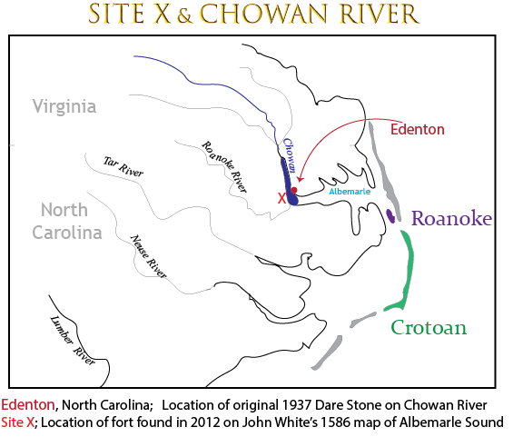
Dare Stones, Edenton, and Site X
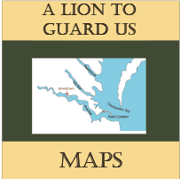
In 1937 the Dare Stone hoax began. First a single stone was found, and in close succession afterwards over 40 other stones claiming to be left by the colonists were found. The 40 stones were proven to be frauds. The original stone was put into that category as well, though others felt it was different enough it should have been examined more thoroughly. However, the history professor who took the stones seriously had his career destroyed. No one wants to take that chance again.But interestingly, the original Dare Stone was found in Edenton. As you can see from the map above, that is close to Site X. The Site X theory was developed in 2012 after the discovery of the fort hidden on the map.
It is impossible to conceive that the same conspirators could manufacture the Dare Stone hoax of 1937 and the Site X Fort of 1584 which was discovered in 2012.
Talk about a case that has gone cold! But maybe someone can solve this one even yet.
Get the Early Settlers Unit Study
Available in Paperback OR Printable Download
199 pages (Includes Student Pages, Teacher Key, Schedule, Maps, Activities, and More)
Print It Now
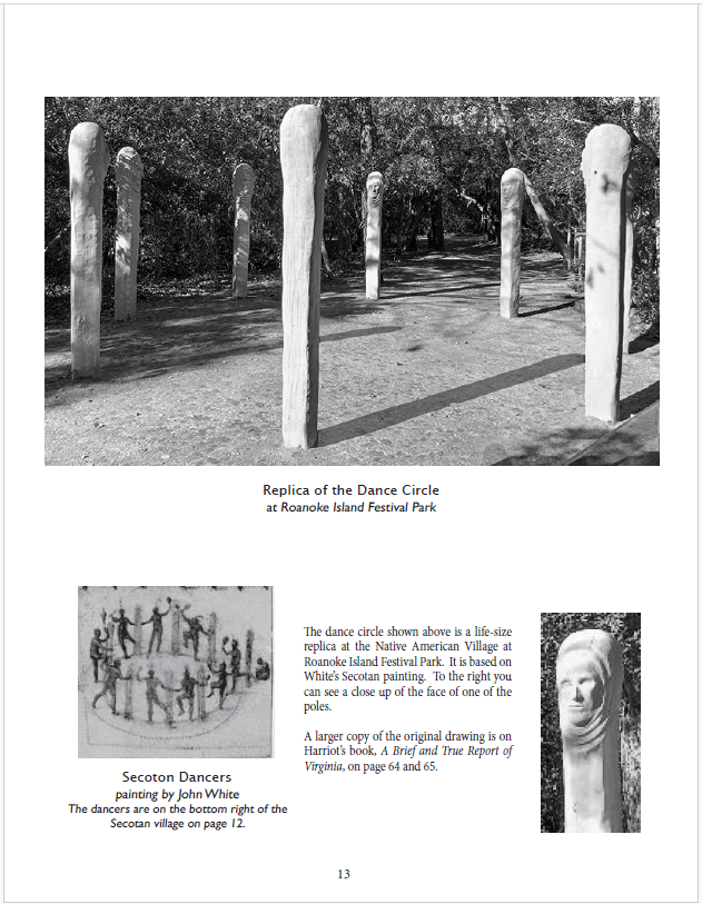
Student and Teacher's Material Included
$5.99 Download - 199 pages
![]()
Softcover Edition - Mailed to You
The same pages are in the softcover book and the printable file. Bound copy is great for repeat use or co-op leaders.
![]()
16.95 Soft Cover Manual
199 pages
Mailed to You
Early Settlers Pages
Check out our other pages for the Early Settlers Unit Study
Get the Lion To Guard Us Unit Study
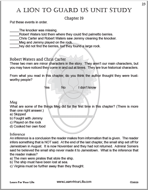
Student Guide AND Teacher's Answer Key Included
$2.99 Download - 78 pages
![]()
Our pages for A Lion To Guard Us
Clyde Bulla's Historical Fiction of Jamestown & the Sea Venture

About Our Site
Hands-On Learning


